The Romans did not choose the location of Barcino by chance. The relatively new colony may have been modest in size, but its function was strategic: to control the territory between the Besòs and the Llobregat rivers, in addition to connecting the Catalan coast with the great trade routes of the Mediterranean. For a long time, historiography considered Barcino a secondary city, overshadowed by the impressive Tarraco. However academic research and recent archaeological excavations have overhauled this image. Today, Barcino is seen as a colony with strong ties to the sea and a port that, despite all the unknowns, hosted intense commercial activity.
An ancient port in Montjuïc
The Romans weren’t the first to carry out regular port operations on Barcelona’s coastline. Long before they arrived, the Laietans, an Iberian people settled there since the 5th century BC on the southwestern slopes of Montjuïc, had already turned this site on the coast into an active point for commercial traffic: the bay, protected by the mountain and the mouth of the Llobregat river, was secure and suitable for anchoring vessels. Archaeological excavations have identified an extensive network of underground silos, near the old coastline. Their capacity far exceeded the needs of a small Iberian village, which indicates that they were used for maritime trade and storing goods. The ships that arrived at this first natural port were mainly Greek, though Phoenician and Punic ships also passed through here.
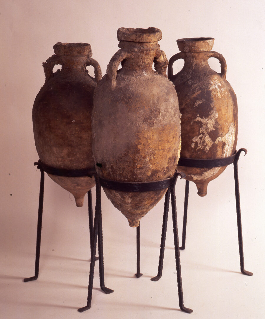
With the founding of Barcino towards the end of the 1st century BC, the Romans continued to use the port area of Montjuïc, at least in part. The presence of a Roman quarry on the southern slope of the mountain suggests that the small pier was used to transport stone destined for construction in the colony. The discovery of imperial amphorae used in the wine trade also suggests that this site was a point where agricultural products were collected and dispatched before exporting them to other regions of the Empire.
However everything indicates that it was not the city’s main port. Barcino was a strategic settlement and, for an empire that understood the Mediterranean as an inland sea, it is difficult to imagine a colony without its own maritime infrastructure. For this reason, most researchers place a main port intended for trade and also likely for military functions, right in front of the city centre, where the coastal front of the Barcelona’s Ciutat Vella, or Old Town, is today. If this hypothesis is correct, the port of Barcino would have been one of the great maritime enclaves of the Hispanic coast.
Barcino, a local commercial hub
Despite its modest size of just ten hectares and a few thousand inhabitants, Barcino hosted intense economic activity, both inside and outside the walls: it was the logistical centre of a highly productive agricultural and artisanal region. The villages around the Llobregat and Maresme rivers produced a high-quality wine that was stored in amphorae made in local workshops before being shipped to other parts of the Mediterranean. The locals also exported fish paste and oyster. As for connections abroad, ceramics from Gaul, Carrara marble and food from North Africa, Italy and the south of the Iberian Peninsula arrived to Barcino.
Only Tarraco surpassed Barcino in maritime activity in the region. The capital of Hispania Citerior, Tarraco was an impressive city, the political and administrative centre of the province, and one of the main ports in the western Mediterranean. However, Barcino was engaged in intense commercial and maritime activity, and its port acted as a complementary node within the Catalan coastal network. The two cities remained in constant contact, both by sea and by land through the Via Augusta. In fact, while Tarraco and other Roman centres started declining in the 4th and 5th centuries, Roman Barcelona remained a vitally important economic and maritime city that would gradually strengthen its central standing within the region.
A highly active port in front of the colony
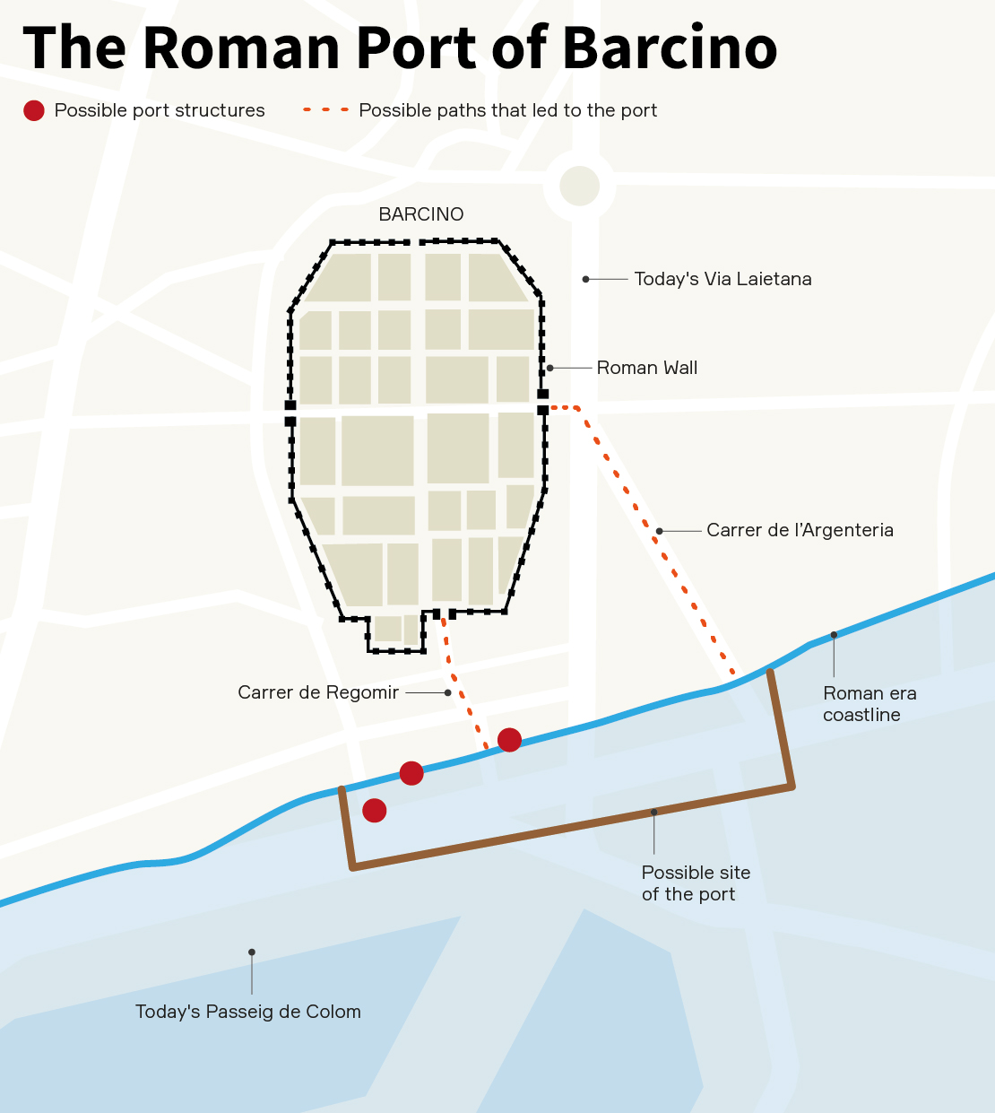
The port area of Barcino would have been located right in front of the city, on a coastline dominated by sandbanks that cushioned the storms from the east and created a natural shelter for boats, making it one of the best maritime enclaves on the Catalan coast. The Porta de Mar of the Roman wall opened approximately on today’s Carrer del Regomir street, the historical road that led directly to the sea, shortly after the Plaça del Regomir square. At that time, with a coastline much further back than our current one, the city was only about 150 metres from the beach.
Two public buildings have been documented on either side of the Porta de Mar that likely corresponded to port limits intended for travelers and merchants arriving in the city, as has been observed in other coastal Roman towns. We can still see their remains today around Pati Llimona and Palau Vilana-Perles. In this same sector, a singular protrusion of the Roman wall, in the form of a fort, has also been identified, which was possibly built between the 4th and 5th centuries to reinforce defensive control over the port area. In fact, the port of Barcino may also have had a military function. An inscription was found in Tàrraco that mentions the position of praefectus orae maritimae laeetanae, probably linked to the control of the Laietana coast, which would have had Barcino as its main centre. This relationship reinforces the hypothesis that the city housed part of the troops responsible to control the region’s coastline and, consequently, would confirm the existence of an authentic Roman port.
The exact location of this port enclave, however, has not yet been precisely determined and it remains one of the great unknowns of Roman Barcelona. Everything suggests that it extended in front of the maritime facade of the ancient city, likely between the current streets of Regomir and Montcada, next to the church of Santa Maria del Mar. The route of the historic street of Argenteria, which left the city through the Portal de l’Àngel, on the eastern side of Barcino, and advanced diagonally towards the sea, is another indication: the route could correspond to an old access road to the port area. In any case, researchers debate whether the port occupied this entire swath of land or whether, on the contrary, it was a smaller and more concentrated space.
There is also no consensus on its exact form. Some researchers consider that it was an essentially natural maritime shelter, exposed to storms, but favoured by the layout of the coast; others argue that it had some artificial structures, though never massive ones, intended to protect the anchorage and facilitate operations. According to this hypothesis, the port of Barcino would not have been a large built complex like those of other cities in the Empire, but rather a natural enclave reinforced with small breakwaters, mortar platforms or retaining walls. Ships would anchor there in front of the city and transfer goods to land with smaller boats. Classical sources on maritime architecture, such as Vitruvius, describe these types of hybrid solutions, in which the Romans took advantage of the natural forms of the coast and complemented them with simple infrastructures to guarantee the safety of navigation and trade.
Unearthed evidence of the Roman port
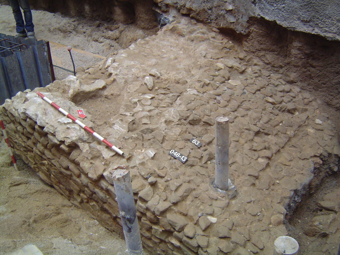
Archaeology could solve the unknowns. Recently, several interventions in the subsoil of Ciutat Vella have uncovered structures located at great depths, right where the coastline was located in Roman times. The most significant discovery occurred between 2013 and 2014 at Passeig de Colom, 9, where a large stone floor fragmented and displaced by the action of the sea appeared. The structure might have been part of a sea wall intended to protect the boats that anchored in front of the city. However, it was not possible to excavate the entire area during the intervention, since part of the flooring continues under the adjacent building.
A few years earlier, in 2011, an excavation at Carrer Ample, 46, had identified a large wall built with stone blocks that may correspond to the foundations of a port infrastructure. Finally in 2017, a platform of stone and lime mortar, very similar to pavements discovered in other Mediterranean ports, was located at Carrer de la Mercè, 17-19 which has led some researchers to relate it to a possible coastal breakwater. At the same time, interventions in the area around Estació de França have located Roman strata with abundant fragments of amphorae and marine sediments, indications that reinforce the hypothesis that this sector of the city hosted an anchoring area.
Despite these occasional discoveries, 2,000 years after the foundation of Barcino, its port remains one of the great unknowns buried beneath Barcelona. The constant transformations of the coastline, urban expansion and the overlapping of centuries of history have erased much of the visible evidence of that first maritime enclave, which has now become one of the main logistics infrastructures in Europe. However, archaeological remains and historical sources increasingly sketch the outline of a deeply maritime city from its origins. Perhaps the great Roman port of Barcino has not yet appeared definitively, but everything indicates that it remains hidden beneath the streets of Ciutat Vella, waiting for future excavations to rediscover it.